
Friday May 18, 2018
Weather agencies across the globe are keeping an eye on a relatively rare tropical storm that’s strengthened in the Gulf of Aden, with potential impacts for Horn of Africa nations including Djibouti and Somalia.
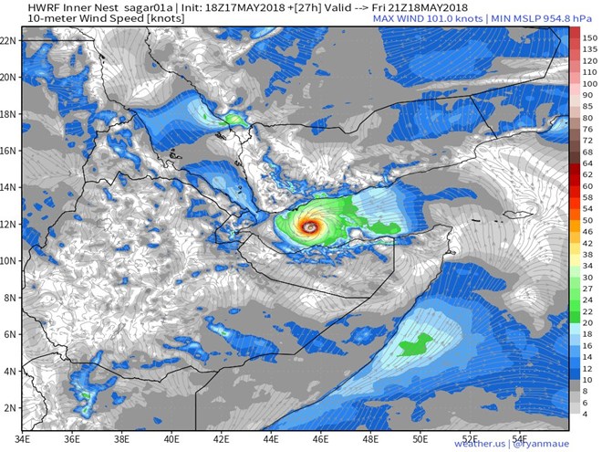
Meteorologist Ryan Maue, a tropical storm expert in the United States, noted an eye feature in the storm, now named Sagar, as the sun rose early Friday. One hurricane model “suggests rapid intensification could be under way,” he said, with near major-hurricane surface winds in the next 24 hours.
“The storm has still over 48 hours over the very warm water of the Gulf of Aden,” he added.
Oman’s meteorology agency said the storm had no direct effects there as it headed toward Yemen and the Horn of Africa states. Yet it remains a concern because of the potential for heavy rains and flash flooding in populated regions facing ongoing humanitarian crisis and long-term drought conditions.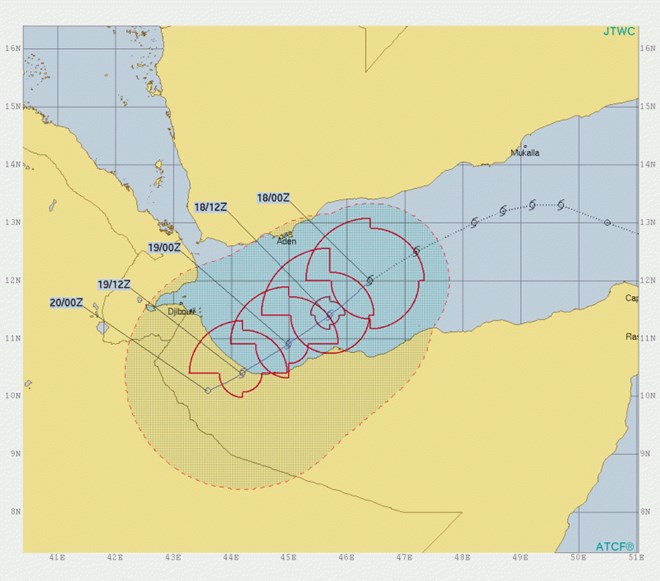
The World Meteorological Organization said just three similar storms have occurred in the Gulf of Aden since 1968. The WMO warned of high winds, rain and risk of floods in affected countries, as did other agencies.
“Similar events in recent years in both Yemen (2008 Cyclone) and Somalia (2013 Cyclone) have led to hundreds of human fatalities, the large scale loss of crops, livestock and destruction of property and infrastructure,” the UK Met Office said. The storm is similar in severity to the 2013 storm, they added.
“Across Northern Somalia, 50-100mm of rain could fall widely, with peaks in excess of 250mm,” the British agency said. “This area usually receives little rainfall away from the Ogo Mountains.”
There’s still uncertainty about the direct track and timing of the storm, but it was headed for Somalia this weekend, according to the latest forecast from the Joint Typhoon Warning Center. The JTWC also forecasts some intensification before Sagar reaches land.